How to read keyline on a quarter-acre — a Pakistan smallholder primer
Keyline design has a reputation for being something you do with a bulldozer across a thousand acres. It is not. The idea P. A. Yeomans set out in the 1950s is fundamentally about reading how water moves across land and placing your planting to slow and spread it — and that reading works exactly as well on a quarter-acre as on a cattle station. For a Pakistani smallholder, keyline is not earthmoving. It is a way of seeing the slope you already have, so that every drop of rain or canal water travels a little further across your land before it leaves.
The one concept to understand: the keypoint
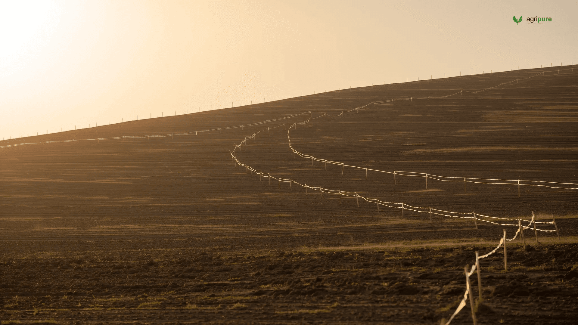
Walk any sloping land and you will find that the hillside is not a uniform ramp. It steepens near the top and flattens toward the valley floor, and the place where the steeper upper slope transitions into the gentler lower slope — in the primary valley, the natural water-collecting fold of the land — is the keypoint. Water accelerates above it and slows below it. The keypoint is where Yeomans said the water wants to pause, and therefore where your design should help it pause. Find the keypoint and the line you run level across the slope from it — the keyline — is the reference for everything else: where to plant, where to mulch, where to place a swale if you build one.
Finding the keypoint with an A-frame, not a laser
The whole method is accessible with a tool you can build from three sticks. An A-frame level — two legs and a crossbar with a hanging plumb line — finds true level points across a slope; walk it along the hill, marking each point where the plumb hangs centred, and you have traced a contour. To locate the keypoint, walk the primary valley downhill until the slope visibly eases; that transition zone is your keypoint, and the contour you mark through it is the keyline. Stakes, an A-frame, a line level, and a tape are the entire kit. No survey instrument, no power, no contractor.
On a quarter-acre the keyline pattern usually means one thing in practice: align your tree rows, mulch berms, and any shallow infiltration trench parallel to the keyline rather than straight up-and-down the slope or rigidly on contour. Yeomans’ insight was that cultivation and planting run slightly off-contour — drifting water gently from the valleys toward the ridges — spread water sideways across the land instead of letting it rush down the wettest fold. Even at small scale, rows laid this way turn a slope that sheds water into one that combs it across the planting.
How keyline interacts with canal command areas
Most Punjab and Sindh smallholdings are not rain-fed hillsides; they are near-flat plots inside a canal command area, irrigated by gravity flow on a fixed rotation. Does keyline still apply? Partly. On genuinely flat canal land there is no keypoint to find and the earthworks logic falls away — but the underlying discipline, read the micro-slope and lay your beds and channels to move water slowly and evenly across the plot, is exactly what good basin and furrow layout already does. Where a plot has any fall at all — and most do, by the few centimetres that decide which corner waterlogs and which stays dry — keyline thinking tells you to run beds across that fall, not down it, so the irrigation sheet spreads rather than races to the low corner. Keyline does not replace the canal; it makes the canal water you receive cover more ground.
Start by walking, not digging
The cheapest, highest-return keyline action on a quarter-acre is not earthwork at all. It is spending an afternoon with an A-frame learning where your water actually goes — which corner floods, which dries first, where the keypoint sits if you have any slope. That map, drawn in stakes, tells you where the trees that want more water should stand and where the drought-tolerant pioneers belong. Most smallholders plant by plot boundary and inherit the field’s water problems. Plant by keyline and you design them out — with three sticks and a plumb-bob.