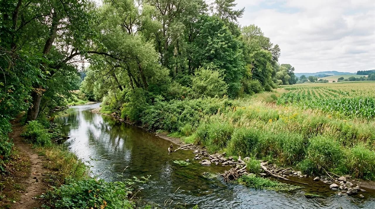
A functional riparian forest buffer is a structured transition zone between agricultural land and a freshwater aquatic ecosystem. Unlike unmanaged volunteer growth along a creek, an engineered buffer organizes vegetation into three coordinated ecological zones that progressively slow surface runoff, filter dissolved agricultural nutrients, and stabilize fragile bank soils through deep root networks. Designing these systems requires matching vegetation structure and total corridor width to local hydrology, slope gradient, and upstream land-use pressures.
When planned within broader agroforestry systems, riparian buffers protect surface waters while maintaining the productive integrity of adjacent working fields. Understanding their internal architecture allows researchers, students, and land managers to evaluate how vegetative buffers function as dynamic biological filters rather than static border plantings.
Beyond planting trees near water: the agroforestry distinction
A common misconception in watershed restoration is that simply allowing woody vegetation to colonize a streambank creates a functional buffer. While unmanaged riparian corridors provide wildlife habitat, they frequently fail to address the hydraulic and chemical pressures imposed by modern agricultural fields. Concentrated runoff from tilled slopes can carve gullies directly through unmanaged tree stands, bypassing root zones entirely and delivering sediment into the stream channel.
In contrast, an intentional riparian buffer designed according to formal agroforestry principles works as a sequential treatment system. The vegetation alters the physical behavior of runoff before it reaches the aquatic zone. Surface water first encounters stiff vegetation that dissipates kinetic energy, forcing suspended soil particles out of suspension. Only after runoff velocity has been reduced can the subsurface root systems and microbial communities of woody plants effectively interact with dissolved contaminants. Within the spectrum of recognized types of agroforestry, riparian buffers are a practice where hydrological protection is the primary design criterion, with timber or specialty crop production structured around water quality objectives.
The three-zone structural model
The foundational template for agricultural riparian forest buffers is the three-zone design model. This model establishes three distinct bands of vegetation parallel to the stream bank, each fulfilling a discrete hydraulic, chemical, or biological role.
``` +-------------------+--------------------+-------------------+----------------+
ZONE 3 | ZONE 2 | ZONE 1 | STREAM |
Herbaceous Strip | Managed Woodland | Streamside Forest | Aquatic Zone |
Traps sediment, | Nutrient uptake, | Bank stability, | Open water, |
| spreads runoff | biomass harvest | shade, detritus | aquatic biota | +-------------------+--------------------+-------------------+----------------+ ```
Zone 1: the streamside forest
Zone 1 occupies the immediate margin of the watercourse, extending landward from the top of the active streambank. The primary functions of Zone 1 are physical bank stabilization, aquatic habitat moderation, and biological contribution to the stream ecosystem:
- Streambank Stabilization: The root networks of mature native trees bind bank sediments together. Deep roots anchor into lower strata, while lateral roots resist hydraulic shear stress during flood flows.
- Thermal Moderation: Canopy cover intercepts direct solar radiation, preventing severe water temperature spikes during warm seasons and preserving dissolved oxygen for aquatic organisms.
- Ecological Inputs: Leaf litter, insect drop, and coarse woody debris from Zone 1 provide base carbon and physical cover for in-stream food webs.
Because soil disturbance in Zone 1 directly threatens bank integrity, this zone is maintained as an undisturbed forest strip. Timber harvesting, grazing, and heavy equipment operation are excluded. Species selection focuses on native species capable of surviving periodic inundation, such as willows, alders, river birches, and bottomland hardwoods.
Zone 2: the managed forest and shrub belt
Located immediately upslope from Zone 1, Zone 2 consists of a belt of managed trees and woody shrubs that acts as the primary biogeochemical processing zone:
- Nutrient Uptake: Subsurface water passes through the root zone of Zone 2. Fast-growing woody plants absorb excess dissolved nitrogen and phosphorus, converting mobile nutrients into plant tissue.
- Denitrification Support: Tree roots deposit organic carbon that fuels anaerobic denitrifying bacteria in shallow saturated soils, converting mobile nitrate into inert atmospheric nitrogen gas.
- Secondary Production: Zone 2 can accommodate periodic management. Land managers frequently incorporate commercially useful species, including timber hardwoods or fruiting shrubs, provided harvest methods preserve soil structure and continuous canopy cover.
Zone 3: the grass and herbaceous filter strip
Zone 3 forms the outer perimeter of the buffer system, positioned directly adjacent to agricultural fields. This zone consists of dense perennial grasses and deep-rooted forbs:
- Runoff Spreading: Dense grass stems provide high hydraulic roughness, forcing concentrated micro-channel flows to spread out evenly as sheet flow.
- Sediment Deposition: By reducing surface water velocity, Zone 3 forces suspended soil particles to settle out before reaching woody zones. Because particulate phosphorus binds to soil particles, this settling traps a significant fraction of phosphorus runoff.
- Buffer Protection: Zone 3 provides a working buffer between farm machinery and the tree canopy of Zone 2, preventing tillage equipment from damaging tree root crowns.
Hydrological mechanics and pollutant interception
To evaluate a riparian buffer effectively, students must trace the pathways through which agricultural pollutants travel toward surface waters: surface runoff, shallow subsurface flow, and deep groundwater bypass.
When surface water moves across agricultural fields during intense rainfall, it carries suspended sediment, particulate phosphorus, and surface residues. As detailed in field guides to farm runoff management, vegetation acts as a physical filter. In a properly graded Zone 3 grass strip, laminar sheet flow allows fine particles to drop out of suspension. However, if runoff enters the buffer as channelized flow, vegetation gets flattened and sediment passes through. Proper field contouring upslope of the buffer helps maintain broad sheet flow.
Subsurface hydrology governs the fate of soluble agricultural inputs, especially nitrate. In areas with high water tables, lateral subsurface groundwater moves through the upper soil horizon where tree roots and organic matter are concentrated. Under these moist conditions, denitrifying microbes reduce nitrate ions to gaseous nitrogen. For this process to occur, water must move slowly enough through the root zone to provide sufficient contact time.
Deep groundwater flow presents an inherent physical limit to buffer performance. Where agricultural drainage tiles bypass the root zone, or where coarse subsoils route water beneath tree roots, buffers cannot intercept dissolved nutrients. Addressing tile drainage requires targeted practices such as constructed wetlands or saturated buffers integrated directly into the buffer layout.
Width, slope, and siting considerations
A central question in agroforestry literature is how wide a riparian buffer must be to achieve measurable ecological outcomes. While statutory guidelines sometimes specify uniform widths, biological performance depends on site-specific factors:
Landscape Variable | Impact on Buffer Mechanics | Design Adaptation |
|---|---|---|
Slope Gradient | Accelerates runoff velocity, reducing settling time | Widen Zone 3 grass strip; incorporate contour swales |
Soil Texture | Sandy soils allow rapid infiltration; heavy clays promote surface runoff | Expand herbaceous strip on clays; use deep-rooted trees on coarse soils |
Contributing Area | High upslope drainage ratios overwhelm small buffers | Scale total buffer width proportionally to watershed area |
Hydraulic Flow Type | Channelized flow creates bypass corridors through vegetation | Install level-lip spreaders along field boundaries |
Stream order also dictates buffer dimensioning. First- and second-order headwater streams account for the majority of total stream length in a river basin and maintain the highest land-to-water contact area. Consequently, installing multi-zone buffers along headwater creeks produces greater basin-wide water quality improvements than wide buffers installed solely along large, downstream rivers.
Species integration and root architecture
Designing a resilient buffer requires matching species traits to ecological niches across the moisture gradient. In the waterlogged soils of Zone 1, selected trees must tolerate hypoxic root zones during floods while maintaining strong taproots and expansive lateral anchors.
In Zone 2, combining species with complementary rooting depths optimizes nutrient scavenging across the soil profile. Deep-rooted hardwoods access deeper subsoil water, while shallow-rooted shrubs capture nutrients moving through topsoil layers. Incorporating adapted nitrogen-fixing trees or non-timber forest species such as native berry producers or medicinal herbs can yield secondary economic returns for landholders without sacrificing conservation functions. At agripure, field studies emphasize that productive agroforestry components must remain secondary to the primary environmental buffer mechanism.
Management realities and maintenance cycles
Riparian forest buffers are managed biological infrastructure that requires deliberate long-term maintenance:
- Sediment Cleanout: Over years of trapping soil, the outer edge of Zone 3 can form a raised sediment berm that prevents field water from entering the buffer, diverting runoff into low points where it forms erosive channels. Periodic scraping or re-seeding is required to restore sheet flow.
- Nutrient Removal via Biomass Harvest: Trapped phosphorus remains in the soil and vegetation. Without periodic harvesting of woody biomass or haying in the outer zones, buffer soils can eventually become saturated with phosphorus, reducing net retention.
- Invasive Plant Management: Open riparian corridors are vulnerable to invasive vines and weeds that can suppress regenerating native trees and destabilize canopy structure.
- Livestock Exclusion: If livestock graze adjacent fields, permanent fencing is mandatory. Unrestricted animal access destroys streambank stability, compacts fragile soils, eliminates herbaceous ground cover, and introduces direct fecal bacteria into the stream channel.
By treating riparian buffer design as an integrated three-zone agroforestry discipline, researchers and land managers can build resilient watershed corridors that reconcile agricultural production with downstream aquatic health.